
MASSIV: The Statistics
Hiking through four mountain regions, covering more than 400 kilometres over 21 days, can generate a ton of data.
In my case, most of the data were collected by my Garmin Fenix 7X Sapphire Solar watch, temperature data was collected with a connected Garmin Tempe, and satellite breadcrumbs were collected with my Garmin inReach Mini safety device.
One of the things I was curious about while planning this expedition was what kinds of data and statistics I could collect, and whether or not they would be of any practical use. The answers are probably that you can collect a vast amount of data, but the usefulness of at least some of them is limited.
Longest, Furthest, Hardest
| Data Point | Section | Data |
|---|---|---|
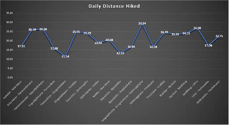
| Longest section (km) | Iungsdalshytta - Kongshelleren - Geiterygghytta | 29.54km |
| Shortest section (km) | Ekrehytta - Skogadalsbøen | 11.54km |
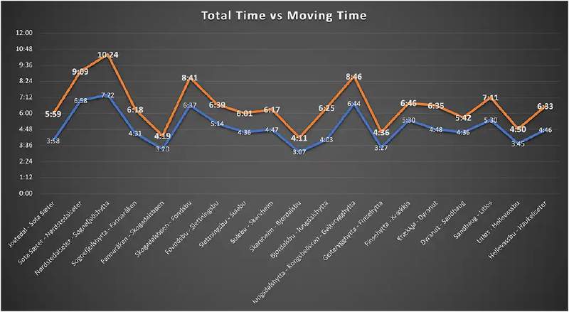
| Shortest time (hh:mm) | Breistølen - Bjordalsbu | 4:11 |
| Longest time (hh:mm) | Nørdstedalseter - Sognefjellshytta | 10:24 |
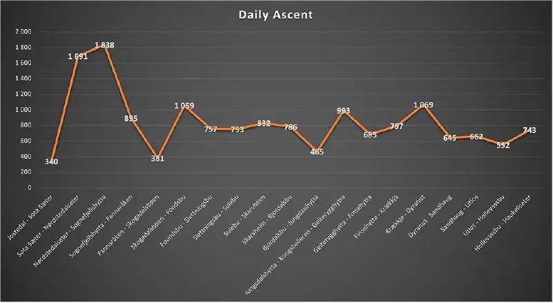
| Steepest ascent (m) | Nørdstedalseter - Sognefjellshytta | 1838m |
| Gentlest ascent (m) | Ekrehytta - Skogadalsbøen | 381m |
| Steepest descent (m) | Sota Sæter - Nørdstedalseter | 1 497m |
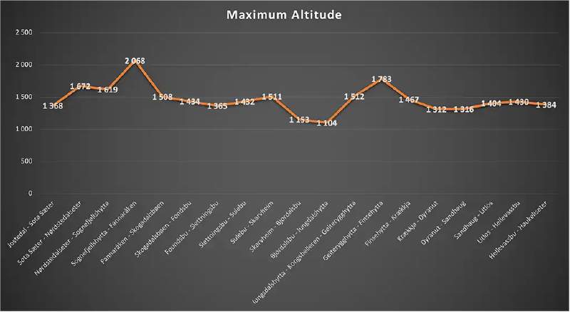
| Max altitude | Fannaråken | 2 068m |
| Min temperature | Finse | 4 °C |
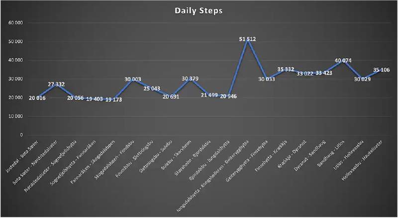
| Most daily steps | Iungsdalshytta - Kongshelleren - Geiterygghytta | 51 512 |
| Least daily steps | Ekrehytta - Skogadalsbøen | 19 173 |
| Total distance hiked | < Entire Expedition > | 401.86km |
| Total time hiked (moving) | < Entire Expedition > | 93 hrs |
| Total time hiked (total) | < Entire Expedition > | 125 hrs |
| Total number of steps | < Entire Expedition > | 543 072 |
| Total ascent | < Entire Expedition > | 15 941m |
Note: The data do not represent the rest days at Skogadalsbøen and Geiterygghytta
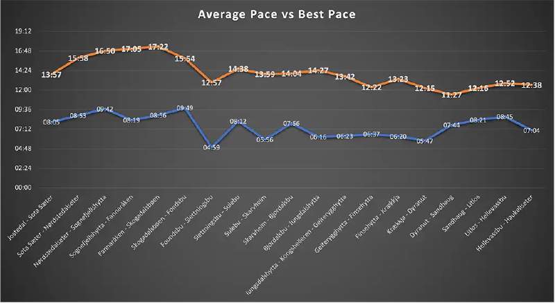
Graphical representations
No statistics section would be complete without some graphs:
In the highly unlikely event that anyone would care to see more data, may I recommend reaching out through my Facebook page; I’d probably be happy to share. The Excel spreadsheet with all the imported Garmin data is surprisingly comprehensive.