The traverse from Nigardsbreen to Steinmannen represents a complete alpine challenge, combining technical glacier travel with classic mountaineering in Norway’s Jostedalsbreen region.
Starting from one of Norway’s most accessible glaciers, the route ascends through increasingly complex terrain, including two distinct icefalls, before reaching the rocky outcrop that gives Steinmannen (“The Stone Man”) its name. Our team’s recent experience on this route tested both our glacier and alpine skills whilst providing valuable insights about equipment choices and tactical decisions in this dynamic environment.
The Landscape: Nigardsbreen and Steinmannen

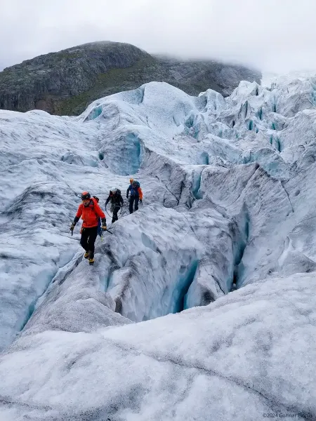
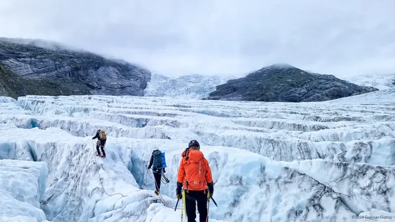
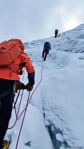
Approaching the first icefall
Nigardsbreen Glacier shows two distinct sides. Its lower section provides easy access for tourist groups and new climbers to practise basic glacier skills. As you move upward, the terrain changes significantly. The first icefall marks where the glacier becomes more challenging, whilst the second icefall transforms into a maze of ice formations. Here, large ice towers called seracs can collapse without warning, creating a complex landscape of shifting crevasses that only experienced climbers should attempt to navigate.
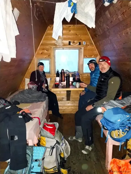
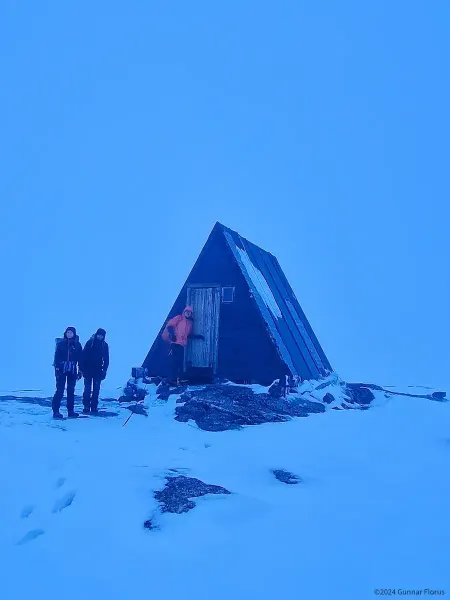
At the top of the glacier stands Steinmannen, a simple emergency shelter built on solid rock. With just two narrow bunks, a gas stove, and minimal space, this basic refuge served its purpose when we stayed the night. We adapted to the tight quarters by sleeping two per bunk, head-to-foot, sharing both the camaraderie and inevitable close contact such arrangements bring.

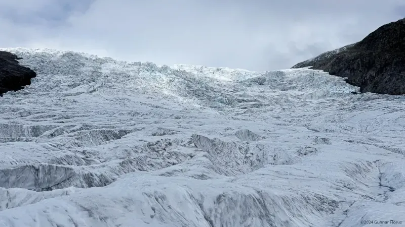
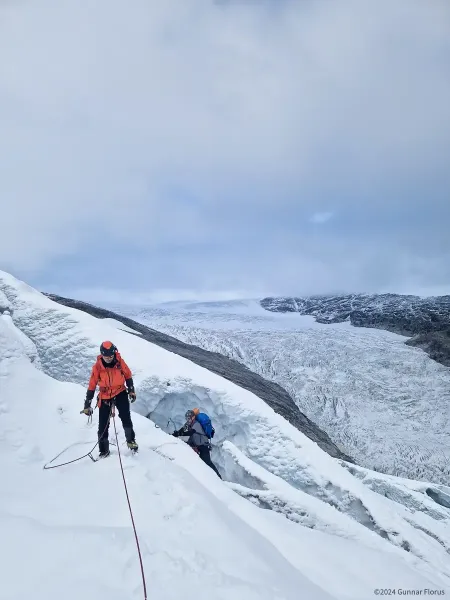
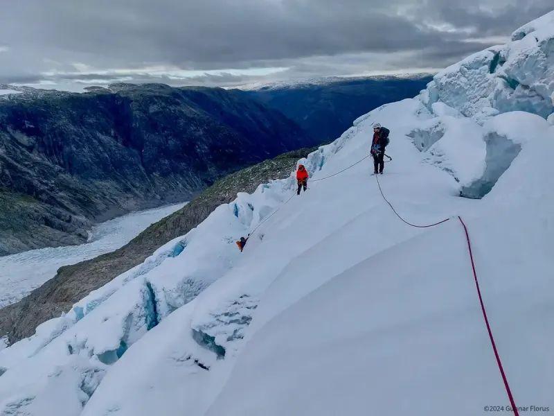
A maze of crevasses as you reach the plateau between the first and second icefall
Preparation – Ferdaråd
A glacier expedition is a balance between meticulous planning and adapting to unpredictable conditions. Our preparation included a Ferdaråd, a traditional Norwegian practice for mountain safety, where the team gathers to align on planning, scope, resources, and emergency procedures. This protocol builds both clarity and cohesion before embarking on a climb.
During our Ferdaråd, we agreed on several key elements:
Equipment
Common Safety Gear:
- Rope systems (dry-treated, 9mm, 50-60m)
- Garmin inReach Mini satellite communicator
- Emergency bivouac shelter
- Extra rope and pulley systems for crevasse rescue
- Spare crampon
- Glacier-specific first aid kit
- Multitool and Repair Kit
Individual Gear:
- Lightweight alpine climbing harness
- Two technical ice axes (with leashes)
- Crampons certified for blue ice
- Prusik loops (3x per person)
- Ice screws (3x per person)
- Personal belay device and compatible carabiners (locking and non-locking)
- Headlamp with spare batteries
- Water
- High-energy food
Timing, Start Time, and Cutoff Points

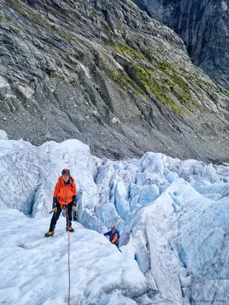
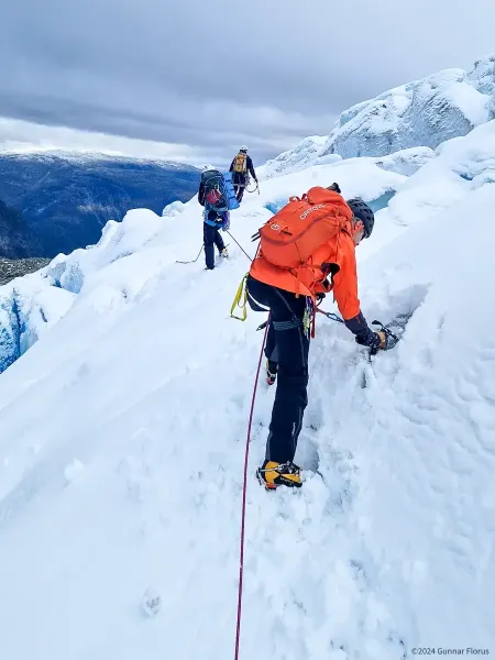
Roping up for traversing the first icefall
An early start is always preferable, and we opted to begin the 2km approach to the glacier tongue in darkness. In hindsight, we should have started even earlier.
Based on beta from previous climbers, we established key cutoff points:
- Cutoff time: Reach the second icefall by noon or turn back
- Point of No Return: Beyond the first third of the second icefall, it would be safer to press on rather than retreat
We also adhered to the 50/10 rule, pressing forward for 50 minutes followed by 10-minute breaks to address all needs, from eating and drinking to clothing adjustments. This discipline reduced unnecessary stops and ensured efficiency.
Speed vs Safety
Travelling unroped on a glacier significantly reduces the time required to navigate, as there is no need to set ice screws, clip in and out, or retrieve gear. However, this approach carries a higher individual risk in case of a crevasse fall or other incident. Conversely, roped glacier travel provides greater collective safety but at the cost of much slower progress due to the technical and logistical demands of the system. This slower progress significantly increases the risk of running out of daylight, leaving you stuck in complex and dangerous terrain in pitch-black darkness.
Technical Considerations
The Glacier Route: Five Key Segments
- Lower Glacier: Accessible terrain with moderate crevasses and steep sections
- First Icefall: A stunning display of towering seracs and deep crevasses
- Mid-Plains: A plateau between the icefalls requiring careful movement
- Second Icefall: The most complex section, featuring towering seracs and a maze of crevasses
- Upper Glacier: Zigzagging crevasses and hidden snow bridges leading to Steinmannen
Lower Glacier
The lower section of Nigardsbreen is the most straightforward and accessible part of the glacier, making it an obvious candidate for unroped travel to prioritise speed. The terrain is relatively forgiving, albeit with moderate crevasses and steep sections requiring vigilance.
Lower Icefall

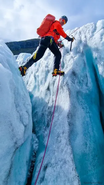
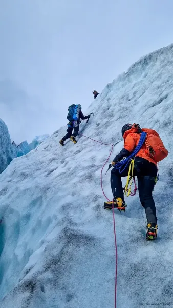
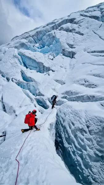
Crossing crevasses
The lower icefall introduced the first major technical challenge. We initially proceeded unroped, focusing on speed and efficiency. However, halfway through, we opted to rope up, prioritising safety over time. Trusting our cutoff time, we navigated the icefall’s northeastern side, providing a relatively straightforward route before gradually transitioning toward the glacier’s centre.
In hindsight, remaining unroped might have been a faster option without significantly compromising safety, but this decision is always condition-dependent.
Mid-Plains
Crossing the middle plateau required a roped setup, though we opted not to set anchors. The plateau, while seemingly less technical, carried its own risks as we could hear the faint roar of rivers running beneath the ice. This served as a constant reminder of the glacier’s dynamic and unpredictable nature.
At the edge of the second icefall, we took advantage of a safe spot to pause for a proper rest and food break. From a timing perspective, we reached this point just before noon, staying within our agreed cutoff time. The second icefall, viewed from below, appeared relatively straightforward—a perception supported by the beta we had received two days earlier. With this confirmation, we began our ascent.
Upper Icefall Navigation

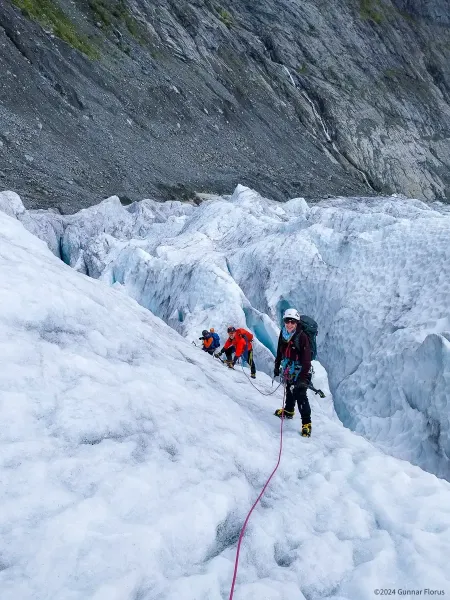
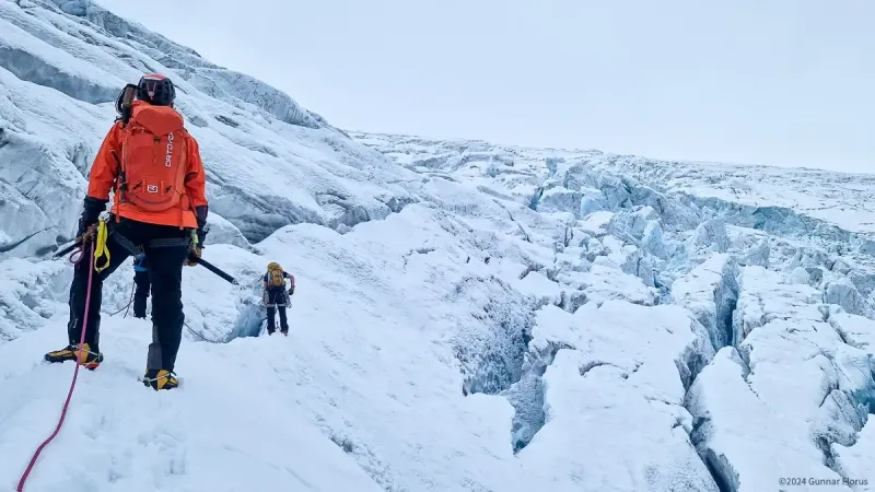
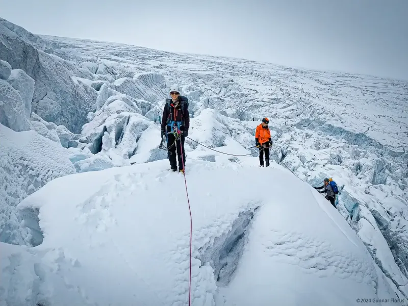
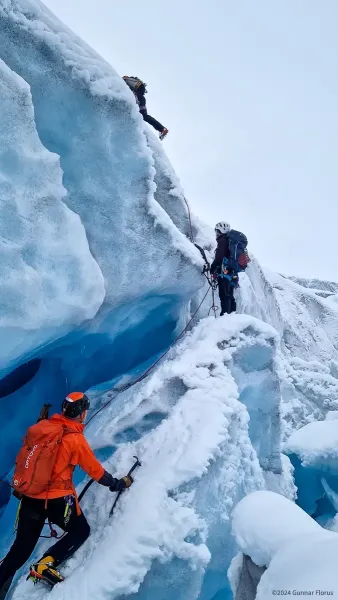
Complex climb across seracs and crevasses in second icefall
The upper icefall quickly proved to be significantly more challenging than anticipated. Its complexity demanded constant assessment and precise navigation through a maze of towering seracs and deep crevasses.
About halfway up, we encountered a striking glacier portal where a rushing meltwater river emerged from beneath the ice, vividly illustrating the glacier’s dynamism. To the right, the aftermath of a recent serac fall sprawled across the slope—a chaotic field of shattered ice blocks that reinforced the glacier’s unpredictable nature.
The crux of the route lay roughly two-thirds up the icefall, where colossal seracs—some as tall as 20 metres—were scattered like giant Lego blocks haphazardly thrown down the slope. Navigation here became labyrinthine, forcing us to backtrack multiple times. Our route setter, Christophe demonstrated remarkable skill, expertly guiding us through the maze. Progress was slow but steady, though it became clear that our time estimates were no longer accurate.
The serac fall had fundamentally altered the terrain, rendering previously reliable beta obsolete. We were nearly stuck on one serac as daylight dwindled, adding urgency to an already demanding situation.
At one particularly harrowing point, we had to leap across a bottomless crevasse, landing on a vertical ice wall with ice axes and crampons. This required precise coordination with the rest of the team to manage rope slack—enough to allow the jump but not so much that a fall would become catastrophic. Fortunately, there were no incidents, but the manoeuvre underscored the complexity and risks inherent in this terrain.
Upper Glacier

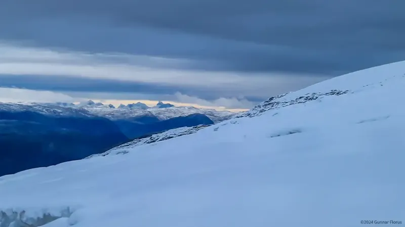
View towards Hurrungane
The feeling of reaching the top of the icefall was near euphoric, but the journey was far from over. The final plateau leading to Steinmannen presented its own set of challenges. Hidden beneath 20–30cm of loose snow lay a zigzag pattern of crevasses, creating a minefield that demanded constant vigilance.
Despite experiencing multiple minor falls, our rope technique proved effective, allowing us to maintain steady progress. We reached Steinmannen just as the last rays of sunlight disappeared, plunging the glacier into pitch-black darkness.
A Night at Steinmannen

Steinmannen emergency shelter
Steinmannen is your typical, minimalist emergency shelter. It is unlocked and available year-round, provides shelter from the elements, two minimalist beds, a small table, and a minimal cooking top with gas. Before settling in, we made a point of sending a satellite message to basecamp to let everyone know we were safe. Furthermore, we prioritised a quick debrief, a plan for getting organised, and then got to work. We slept two people in each slim bed, foot to head, and while it was cold, hard and a tad smelly with my friend’s smelly feet cradling my head, we were safe, content and happy to have made it. I cannot claim anyone slept well, but we were sufficiently rested the next day that we could start the long hike down.
Return Home
The descent followed a different route, this time on firm ground rather than the glacier. However, 20cm of fresh snow obscured the path, making navigation difficult and treacherous. The hidden terrain was slippery, and with sheer 50–100m cliffs nearby, every step required heightened focus to avoid a potentially catastrophic fall.
Fatigue from the previous day’s significant effort, combined with a poor night’s sleep and the emotional toll of navigating the glacier, weighed heavily on the team. Despite these challenges, the satisfaction of completing the journey made every step worthwhile. After another seven hours of steady progress, we finally returned to basecamp, exhausted but elated by our success.
Critical Decision Points
Timing Considerations
- An early start proved essential for optimal ice conditions and maximising daylight
- Conservative turnaround times were critical for ensuring safety in complex terrain
- The 50/10 rule (50 minutes moving, 10 minutes resting) optimised efficiency and helped conserve energy
Route Selection
- We approached each transition with a thorough assessment of options, complete with fallback plans and safety measures
- Continuous evaluation of ice conditions influenced route decisions
- Team input was balanced against time constraints, maintaining both safety and progress
Lessons Learned
- Start Earlier Than Early: Using headlamps for the approach is preferable to navigating complex glacier terrain in the dark.
- Respect Time Windows: Conservative turnaround times are essential in technical terrain, especially when dealing with changing ice conditions.
- Treat Beta as Provisional: The glacier’s dynamic nature renders previous route information as historical reference, not gospel.
Looking Forward
The traverse from Nigardsbreen to Steinmannen is more than a technical challenge; it studies the interplay between preparation, adaptability, and respect for nature. As glaciers evolve due to climate change, mountaineers must approach them with heightened awareness and responsibility.
For those considering this route, success depends on technical competence, team coordination, and a willingness to adapt to ever-changing conditions. While the glacier offers moments of breathtaking beauty, it demands respect at every turn.
Nigardsbreen is not just a destination—it’s a dynamic, living entity that challenges and rewards those who venture onto its ice.
Technical Data
| Distance: | 13.19 km | Average speed: | 0.98 km/h | |
| Total ascent: | 1636 m | Avg. moving speed: | 1.78 km/h | |
| Total descent: | 293 m | Maximum speed: | 6.89 km/h | |
| Total time: | 13:26:24.0 | Moving time: | 6:44:37.0 |
Final Reflection
This expedition reinforced the value of teamwork, preparation, and adaptability. The lessons learnt on Nigardsbreen will inform future climbs and the approach to all alpine objectives.
As glaciers like Nigardsbreen continue to change, so too must our strategies for navigating them. It is a privilege to explore these landscapes—one that comes with the responsibility of respecting their complexity and fragility.


